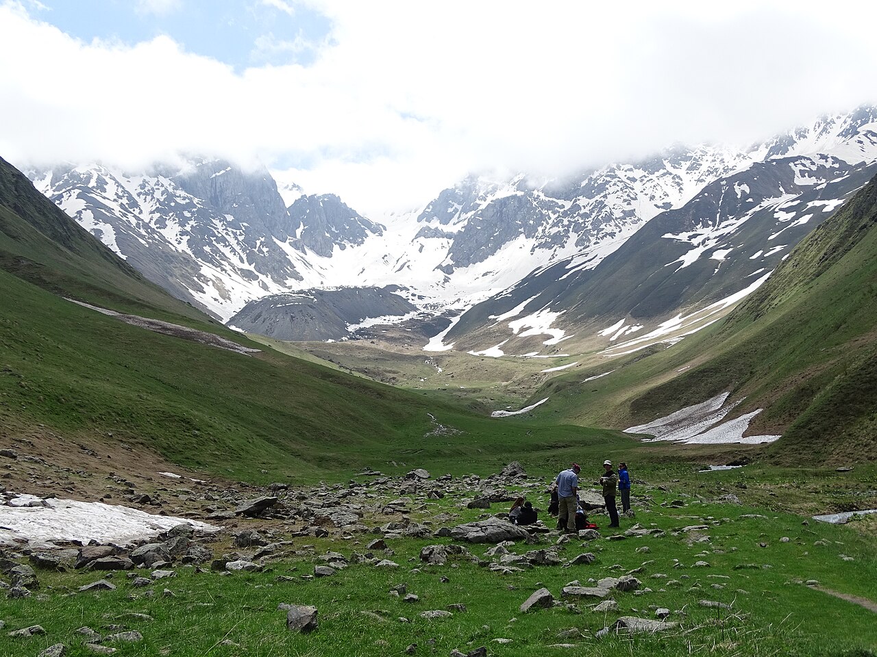
You can be walking a forest ridge above Tbilisi forty minutes after you leave your guesthouse, and you can be on a glacier-view trail in the High Caucasus by lunchtime. The difference is how much of your day, and how much logistics, you are willing to hand over.
So this list is sorted by how far you have to commit, not by how pretty the photos are. It starts with walks you can do in trainers before lunch and ends with a trail that eats a whole day and needs a car or a tour. Pick your rung and stop reading there.
Rung one: trainers, no plan, back before lunch
These start inside the city. No trailhead to find, no transport to book, nothing in your bag except water and a phone.
Narikala ridge to the Botanical Garden
Roughly 2.5 km, about 150 m of descent, 1.5–2 hours with stops. Ride the cable car from Rike Park to the Narikala ridge — 2.5 ₽ each way, Metromoney card only, no cash and no bank card at the turnstile. From the top you walk the ridge path west past the Kartlis Deda statue, then drop on a stepped path into the National Botanical Garden of Georgia, which fills the gorge behind the fortress. Entry to the garden is a few lari and you come out near the sulfur baths.
The fortress itself is fenced off. Narikala has been closed to visitors for a rehabilitation programme and was still shut as of spring 2026, per reporting on the works (checked August 2026). The cable car, the ridge path, St Nicholas Church and the Botanical Garden below are all open, so the trip is not wasted — but the ramparts are not part of it. Our Narikala guide tracks the state of play.
What catches people out: the stepped descent into the garden is uneven and gets greasy for a day or two after rain. If you have knee trouble, walk it the other way and take the cable car down.
Turtle Lake, the lazy version
There is a second ropeway most visitors never find. It runs from Vake Park up to Turtle Lake (Kus Tba), costs 1 ₽ on the same Metromoney card, and turns a 200 m climb into a four-minute ride. At the top you get a small reservoir ringed by cafés and pedalos, a shallow swimming area in summer, and a flat shoreline path you can finish in twenty minutes.
That is not a hike. It is a view with a coffee, and on a hot afternoon it is the right call — the Open Air Museum of Ethnography is a short walk downhill if you want more out of the trip.
Rung two: an easy morning, one Bolt each way
The Lisi Lake loop
3 km circuit, flat, 45 minutes at a stroll. The perimeter path around Lisi is 3 km of smooth surfaced track, not the 5 km figure that gets copied around travel sites. It is the least strenuous thing on this page and by some distance the most sociable: joggers, prams, cyclists, outdoor gym frames, a run of cafés along the eastern shore.
Get there by Bolt for 6–10 ₽ from the centre; city buses run out that way but drop you a walk short of the water. There is no shade worth the name on the western half of the loop.
Our advice: Lisi is a mediocre hike and an excellent evening. Going at 11am to tick it off a list is a waste. Go at six, walk the loop once, eat on the eastern shore and watch the sun go down over the ridge behind the lake.
Rung three: half a day, a bus, and legs that will feel it
This is where Tbilisi hiking gets real. Distances jump from three kilometres to sixteen, the trails leave asphalt, and you need to have looked at a map before you start.
Mtatsminda to Turtle Lake along the ridge
8 km one way, about 3 hours, signposted. The full ridge route between the Mtatsminda plateau and Turtle Lake is 8 km and takes around three hours at a walking pace, per Wander-Lush trail notes (checked August 2026) — considerably more than the short stroll it is often described as. The path runs through pine and hornbeam with regular openings over the city, and it is one of the few trails around here with genuine waymarking.
You can remove the climb by taking the funicular up from Chonkadze Street: 12 ₽ each way, plus a separate 2 ₽ park card, and Metromoney is not accepted on it. Walk north-west along the ridge, finish at Turtle Lake, ride the 1 ₽ ropeway down to Vake.
What catches people out: the funicular shuts for maintenance without much warning, and the amusement park at the top is the only thing signposted, so the trail entrance takes a minute to find. Head for the TV tower side of the plateau.
Kojori, Udzo and the long way home
16 km one way, roughly 4–4.5 hours, almost all downhill. Take a city bus from Freedom Square up to Kojori, a hill village at about 1,300 m that Tbilisi families have used as a summer escape for a century. From there the trail runs along the ridge to the Udzo Monastery — around 3.5 km of forest and meadow — and then drops something like 900 m over the remaining stretch back down to Mtatsminda Park. The the national tourism board publishes a shorter Kojori–Kiketi variant of about 7 km if 16 sounds excessive.
Do it in this direction. Uphill from the city to Kojori is the same trail with all the joy removed.
Rustaveli Avenue is closed to vehicle traffic from 23 July 2026 to the end of November 2026 — the 2 km stretch from Tamar Chovelidze Street to Freedom Square. Buses that used to run it are diverted, so give yourself an extra twenty minutes to reach the Freedom Square stops, and expect the nightly pro-EU demonstrations outside Parliament to add to the confusion in the evening.
Tbilisi National Park and the Saguramo ridge
North of the city, past the Tbilisi Sea, the Saguramo ridge gives you an 11 km round trip through forest and open hillside with some steep pulls, four to five hours on the trail and six or seven once you count getting there. There is no useful public transport to the start; a taxi runs 30–40 ₽ each way and you should book the return or arrange for the driver to wait.
The Tbilisi Sea shoreline itself is a different animal — open steppe, no tree cover, and a reservoir big enough to generate its own wind. Fine in April, punishing in July.
Rung four: Birtvisi, which genuinely needs care
5–8 km, 4–5 hours, and the only route here where people get properly lost. Birtvisi sits about 60 km south-west of Tbilisi inside Algeti National Park: a maze of limestone towers hiding an eleventh-century fortress that armies once gave up on. The walking is not long. The problem is that the canyon is a three-dimensional puzzle — narrow passages between pillars, thirty minutes of scrambling where you will use your hands, a fixed ladder or two, and junctions that all look identical.
Phone signal drops out inside the canyon. Download the route on Wikiloc or an offline map before you leave the road, and go with someone who has done it or with a guide. Wet rock here is not an inconvenience, it is the reason to turn around; the limestone gets slick and the scrambles stop being optional fun.
Getting there without a car is possible but awkward. Marshrutkas from Navtlughi station towards Tetritskaro can drop you at Partskhisi village, leaving a walk to the trailhead and a real problem getting back in the evening. Most people book a driver for the day or take an organised hike, and this is the one trip where that money buys something concrete.
Rung five: the whole day and a three-hour drive
Gergeti Trinity Church at Kazbegi
About 6 km return from Stepantsminda, 400 m of ascent, 1.5–2 hours up. This is the picture that sold you on Georgia: a fourteenth-century church alone on a grassy shoulder at 2,170 m, with the glaciated cone of Mount Kazbek at 5,047 m behind it. The old pilgrims’ path climbs steadily from the village through meadow and pine, and it is a fair climb rather than a hard one.
Marshrutkas leave Didube station for Stepantsminda through the day and cost 15–20 ₽ each way for the 150 km run up the Georgian Military Highway, about three hours when the road behaves. At the top of the village, 4×4 drivers will take you to the church for around 25 ₽ per person or 70–100 ₽ for the whole vehicle.
Our advice: pay for the 4×4 up and walk down. You keep the views, you save your legs the ascent at altitude, and you buy back the hour that decides if you make the last marshrutka home. Purists will disagree, and on a cool clear morning they are right. Full logistics are in our Kazbegi day trip guide.
Weather at 2,000 m turns in half an hour. A shell and a warm layer go in the bag in July, not just October.
Juta and Chaukhi, if you have two days
Worth naming so you can rule it out. Juta, a hamlet at roughly 2,200 m near Kazbegi, is the gateway to the Chaukhi massif and its wall of rock spires. The classic walk goes up to a glacial lake beneath the peaks; strong hikers carry on over the 3,338 m Chaukhi Pass to Roshka in Khevsureti, which is one of the finest treks in the country and absolutely not a day trip from Tbilisi.
Sleep in a Juta guesthouse and give it two days minimum. A short valley walk from the guesthouses gets you the spires in an afternoon if you are only passing through.
Four things that catch people out
None of these are dramatic. All of them ruin days.
Shepherd dogs. Caucasian shepherds guard flocks in the hills above Kojori, around the Tbilisi Sea and all over the mountains, and they are the size of a small bear. They are working, not hunting. If one comes at you: stop moving, look at the ground rather than the dog, do not run, and walk backwards away from the flock at an unhurried pace. Once you are clear of the sheep the dog turns around. Trekking poles held low give you something to put between you and the animal without looking like a threat.
Water. There is nowhere to buy any once you leave the developed shoreline at Lisi or the Tbilisi Sea, nothing along the Kojori ridge, and no reliable spring at Birtvisi. Two litres per person for anything over two hours, and more in August. Tbilisi tap water is safe to fill up from before you go.
Sun. The city hikes are shaded and the ones that matter are not. Kojori’s upper ridge, the Tbilisi Sea steppe and the whole Gergeti climb are exposed for their entire length, and the sun at altitude burns much faster than the temperature suggests. Hat, sunglasses, sunscreen — the same kit you would take to a beach.
Phone signal. Coverage is good on every trail inside the city and patchy the moment you leave it. It disappears entirely in parts of Birtvisi canyon and in the folds below the Saguramo ridge. Download offline maps at home. Wikiloc tracks are more useful than Google Maps out here, because Google frequently shows a trail that ended ten years ago.
When not to go
Three windows where the honest answer is do something else.
- Mid-July to late August, on anything exposed. Tbilisi runs 32–38°C and the low hills hold the heat. Kojori, the Tbilisi Sea and Birtvisi in this window are an endurance exercise. Either start at six in the morning, stick to the shaded Mtatsminda ridge, or go up to Kazbegi where the altitude does the work for you.
- March and the first half of April, in the hills. Mud season. The Kojori and Saguramo trails turn into clay, the descent to the Botanical Garden is slippery, and Birtvisi’s scrambles are dangerous when wet. City paths are fine; anything unpaved is not.
- November to April, above 2,000 m. The Gergeti path holds snow and ice, and the high routes at Juta and the Chaukhi Pass are only reliably clear from late June to early October. Winter Gergeti is a real mountaineering trip, not a hike, whatever the photos on social media suggest.
Which leaves late April to June, and September into October. Those are the two stretches when the hills are green or gold, the air is clear enough to see the Greater Caucasus from the Kojori ridge, and nothing on this list is fighting you.
Frequently asked questions
Can you hike near Tbilisi without a car?
Every trail inside the city, yes — a Bolt, the cable car, the funicular or a Freedom Square bus covers all of them, and Didube marshrutkas get you to Kazbegi for under 20 ₽. Birtvisi and the Saguramo ridge are the awkward two, because the return leg has no timetable you can trust after mid-afternoon.
What should I do if a shepherd dog runs at me?
Stand still. Sudden movement and eye contact both read as a challenge, so drop your gaze, keep your arms down and reverse slowly along the path you came in on until the flock is behind you. Shouting, throwing stones and sprinting all make it worse, and the dog is quicker than you regardless.
Is Narikala Fortress open in 2026?
The fortress interior is not — restoration hoarding has kept visitors out since 2024 and it was still in place through spring 2026. Everything around it works normally: the 2.5 ₽ cable car from Rike Park, the ridge walk to Kartlis Deda, St Nicholas Church and the Botanical Garden path down the back.
Which hike should I pick if I only have one free day?
Gergeti, if you can leave by seven and accept six hours in a van. If that sounds like a bad trade, the ridge from Mtatsminda to Turtle Lake gives you eight kilometres of proper walking, a cable car at each end and enough time left over for the sulfur baths afterwards.
One last thing worth knowing before you pick: the Mtatsminda ridge, Kojori and Saguramo trails all look south or east over the city, which means the light is behind you in the morning and in your face at sunset. Photographers should walk Kojori in the afternoon and Mtatsminda at dawn. If you would rather build a day around the city than the hills, our day trips from Tbilisi roundup and our notes on whether Tbilisi is safe cover the rest.
Featured image: Adam Jones from Kelowna, BC, Canada (CC BY-SA 2.0) via Wikimedia Commons.

Leave a Reply